


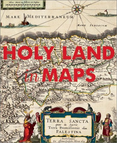
The Holy Land in Maps
Kurzinformation

 Handgeprüfte Gebrauchtware
 Schnelle Lieferung
 Faire Preise
inkl. MwSt. Versandinformationen
Lieferzeit 1-3 Werktage
Lieferzeit 1-3 Werktage

Beschreibung
02 The history of the mapping of the Holy Land epitomizes the history of cartography itself. Situated at the crossroads of Africa, Asia, and Europe, the Holy Land has been the focus of intense interest for countless generations; under its various names--Canaan, The Promised Land, Palestine, or Terra Sancta--it evinces the longest unbroken sequence of mapping in the world. Two principal cartographic traditions dominate this fascinating history: the religious one, based primarily on the Bible and its exegeses; and the classical tradition, represented by Ptolemy, which laid the foundations of modern cartography. The present volume brings together for the first time an historical panorama of these maps: from a 6th-century mosaic from Jordan; through early Hebrew, Christian, and Islamic maps; to maps of the recent past. We see the 13th-century Hereford World Map, with Jerusalem at its center, and the 14th-century Catalan Atlas, drawn on vellum. Anonymous Czech and Italian maps of the 16th century are followed by German, Netherlandish, British, and French maps from the Age of Enlightenment. We arrive ultimately at cartographic representations of the 19th and 20th centuries, culminating in the advent of high-tech satellite imaging. These graphic representations manifest the geographical and political changes that have marked this region over the centuries, suggesting at one time physical realities, and at another persistence of imagination in its creative shaping of the world. Evidenced throughout, Holy Land in Maps is a testament to the painstaking craftsmanship and often delicate beauty that is a hallmark of the mapmaker's discipline at its best. The history of the mapping of the Holy Land epitomizes the history of cartography itself. Situated at the crossroads of Africa, Asia, and Europe, the Holy Land has been the focus of intense interest for countless generations; under its various names--Canaan, The Promised Land, Palestine, or Terra Sancta--it evinces the longest unbroken sequence of mapping in the world. Two principal cartographic traditions dominate this fascinating history: the religious one, based primarily on the Bible and its exegeses; and the classical tradition, represented by Ptolemy, which laid the foundations of modern cartography. The present volume brings together for the first time an historical panorama of these maps: from a 6th-century mosaic from Jordan; through early Hebrew, Christian, and Islamic maps; to maps of the recent past. We see the 13th-century Hereford World Map, with Jerusalem at its center, and the 14th-century Catalan Atlas, drawn on vellum. Anonymous Czech and Italian maps of the 16th century are followed by German, Netherlandish, British, and French maps from the Age of Enlightenment. We arrive ultimately at cartographic representations of the 19th and 20th centuries, culminating in the advent of high-tech satellite imaging. These graphic representations manifest the geographical and political changes that have marked this region over the centuries, suggesting at one time physical realities, and at another persistence of imagination in its creative shaping of the world. Evidenced throughout, Holy Land in Maps is a testament to the painstaking craftsmanship and often delicate beauty that is a hallmark of the mapmaker's discipline at its best.
Produktdetails

So garantieren wir Dir zu jeder Zeit Premiumqualität.


