


Pennine Way Map Booklet
Kurzinformation
Sprache:
Englisch
ISBN:
185284907X
Verlag:
Seitenzahl:
136
Auflage:
-
Erschienen:
2017-03-03
inkl. MwSt. Versandinformationen
Artikel zZt. nicht lieferbar
Artikel zZt. nicht lieferbar
Weitere Zahlungsmöglichkeiten

Beschreibung
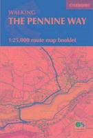
Pennine Way Map Booklet
1:25,000 OS Route Mapping
Map of the 270 miles (435km) Pennine Way National Trail, between Edale in the Peak District and Kirk Yetholm in the Scottish Borders. This booklet is included with the Cicerone guidebook to the trail, and shows the full route on Ordnance Survey 1:25,000 maps. This popular long-distance route typically takes three weeks to complete. von Dillon, Paddy
Produktdetails
Einband:
Kartoniert
Seitenzahl:
136
Erschienen:
2017-03-03
Sprache:
Englisch
EAN:
9781852849078
ISBN:
185284907X
Verlag:
Gewicht:
173 g
Auflage:
-

Alle gebrauchten Bücher werden von uns handgeprüft.
So garantieren wir Dir zu jeder Zeit Premiumqualität.
So garantieren wir Dir zu jeder Zeit Premiumqualität.
Neu
17,00 €
Entdecke mehr zum Thema
")
 (Ordnance Survey Guides to the waterways)")

")
")
")
")
")
")
")

")
 (Pathfinder Maps)")
")
")

")
")

")
![Pacific Crest Trail, Washington South [snoqualmie Pass to Cascade Locks]: NGS Trails Illustrated Topographic Map Guide (National Geographic Trails Illustrated Topographic Map Guide)](https://d3k2uuz9r025mk.cloudfront.net/media/image/44/32/94/1744791421_664478414691.jpg "Pacific Crest Trail, Washington South [snoqualmie Pass to Cascade Locks]: NGS Trails Illustrated Topographic Map Guide (National Geographic Trails...")
")
")
")

")

")

: 109 Large-Scale Walking Maps & Guides to 33 Towns and Villages - Planning - Places to Stay - Places to...")
")


![Alpine Lakes Wilderness [mt. Baker-Snoqualmie and Okanogan-Wenatchee National Forests]: Trails Illustrated Other Rec. Areas (National Geographic Trails Illustrated Map, Band 825)](https://d3k2uuz9r025mk.cloudfront.net/media/image/1c/e5/00/1744790522_45757470590.jpg "Alpine Lakes Wilderness [mt. Baker-Snoqualmie and Okanogan-Wenatchee National Forests]: Trails Illustrated Other Rec. Areas (National Geographic Trails...")
")
")
")
")
")